In our comprehensive surveying services, we specialize in precise GPS and TBM pillar fixing, ensuring accurate geospatial referencing. We conduct GPS static point measurements for high-precision location data, followed by traversing and levelling for seamless ground survey integration. Our expertise extends to topographic mapping, capturing the terrain’s detailed features, and producing clear, precise drawings. These processes ensure reliable data for informed decision-making in all your projects.
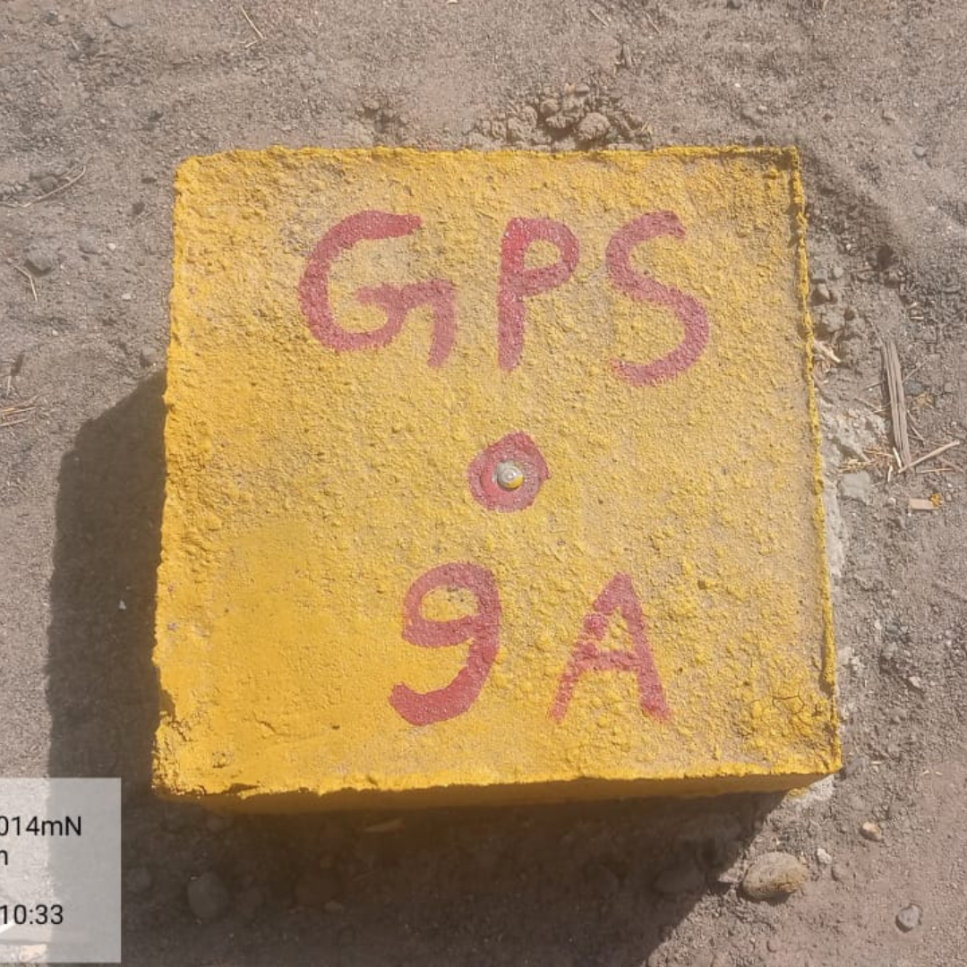
1. GPS & TBM Pillar Fixing
We install TBM pillars, measuring 150x150x600mm, at 200-meter intervals to ensure precise geospatial referencing. GPS pillars, sized 300x300x600mm, are placed in sets of two at visible ground positions every 2.5 kilometers. Our commitment to using the best materials guarantees the highest durability and stability of these pillars, ensuring reliable and accurate survey data.
2. GPS Static Point
Using advanced SOKKIA DGPS equipment, we establish high-accuracy static points with extended observation periods. Employing the best methods, we perform thorough post-processing to ensure the highest level of accuracy. The resulting reports provide precise and reliable data for all your surveying needs.
3. Traversing
We utilize the SOKKIA Total Station Instrument with 1-second accuracy to provide highly precise traversing data. Our traversing is conducted using two methods: (1) Angle Distance Method and (2) Coordinate Method. To ensure the highest quality, client data is verified in the field, achieving an accuracy of 3mm. This meticulous process guarantees reliable and accurate results for your projects.
4. Leveling
We perform TBM fly leveling using advanced digital leveling machines, ensuring precision and reliability. Our leveling data is provided with an accuracy of under 12√ K, meeting the highest standards for your surveying requirements. This meticulous approach guarantees accurate and dependable results for your projects.
5. Topography
We conduct detailed topographic surveys using both RTK and Total Station instruments. Our comprehensive surveys include all utilities and ground levels, ensuring every detail is accurately captured. The collected data is meticulously organized and provided in Excel sheets and drawings, delivering precise and comprehensive topographic information for your projects.
6. Drawing
We provide detailed drawings using corrected raw data from RTK and Total Station surveys. Our drawings include meticulously drafted templates, profiles, L-sections, and cross-sections, ensuring all aspects are accurately represented. This comprehensive documentation supports precise planning and execution for your projects.